


GeoMapper Data Collector
Description of GeoMapper Data Collector
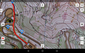
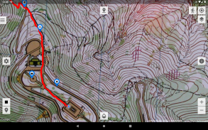
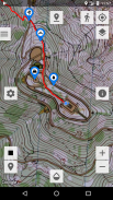
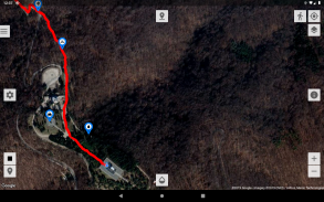
GeoMapper Data Collector is application for collecting geographic information in SQLite database and recording GPS tracks with distance and duration measurement. It can be used for various outdoor activities (hiking, running, cycling, ...) with use of offline maps. With control of offline maps transparency, it can be combined either with other offline maps or with Google Maps, if internet connection is available. You can use number of GIS applications (e. g., Global Mapper (
manual in Serbian
), QGIS) to easily export any map you have and use it as overlay or base map.
NOTE: If App keeps crashing on Android 12, you need to disable notifications from Settings.
Features:
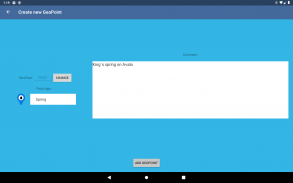
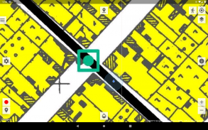
• record GeoPoint at current location, specific coordinate or location picked from map
• set user, project and number for every GeoPoint
• predefined set of mountaineering/hiking types for GeoPoint
• export recorded GeoPoints as SQLite database or in other format (
CSV
,
KML
,
GPX
or
GeoJSON
)
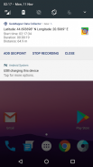
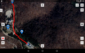
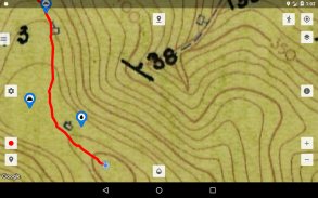
• record GPS track and GeoPoints on it, with basic information about distance and duration
• GPS tracks can be recorded in various formats (
GPX
,
KML
or
GeoJSON
)
• set recording tolerance for accuracy, duration and distance
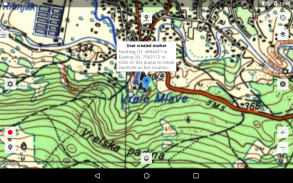
• import and display on map
GPS track
files recorded on other devices and apps
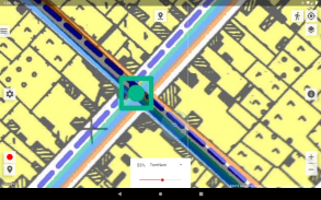
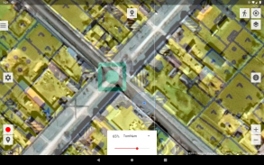
• view/use multiple maps as overlays on base map at the same time
• supported formats for
offline maps
:
- Google Maps Tiles
- non-georeferenced images
-
RMaps
(.sqlitedb)
-
MBTiles
(.mbtiles)
• supported formats for
online maps
:
-
TMS
-
WMS
• set transparency for every displayed overlay
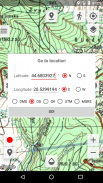
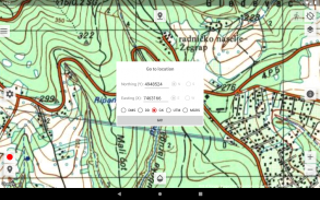
• place pin on specific coordinates and center map on it function
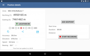
• display info about current location (coordinates, altitude, speed, accuracy) and recording (start time, duration and distance)
• simple compass
• display coordinates in
DMS
or
DD
format
• support for coordinates in
MGI/Balkans zone 5/6/7
, used on topographic maps in Yugoslavia, using Helmerts transformation
• display coordinates in
UTM
or
MGRS
format
• support for using
external SD card
for storing offline maps
• support for altitude correction, based on
Earth Gravitational Model EGM96
and/or
NMEA
sentences
• logging raw GPS data (
NMEA
sentences) to file
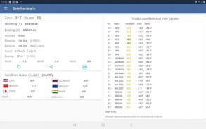
• detailed list of visible
GPS satellites
and their characteristics
• notification panel with location coordinates and information about distance and duration (when recording is active), with additional buttons for adding GeoPoint, start/stop track recording and closing notification panel. It can be turned on via
Settings->Notification settings
tab
• copy, share (via
SMS
,
Viber
,
eMail
, etc.) or save current location (as
KML
)
Setting up SD card for use in GeoMapper Data Collector
tutorial on YouTube
Manual
(pdf file)
GeoMapper channel
on YouTube with tutorials
Permissions:
•
Location
is used for: locating user on the map, creating GeoPoints (at users location) and recording GPS tracks.
•
Storage
is used for: exporting database, GeoPoints and GPS tracks, load GPX files from other sources and for storing offline maps,
•
Internet
is only needed for downloading Google Maps
NOTE: App is working without this permissions and use of internet, but with limited functionality.
GeoMapper Data Collector - Version 1.415
(05-10-2024)GeoMapper Data Collector - APK Information
APK Version: 1.415Package: org.vnuk.geomapperdcLatest Version of GeoMapper Data Collector
Other versions


Apps in the same category

You may also like...


